Locating, Inspecting, & Fault Finding Utilities Equipment for Electric, Gas, Water, Sewer, and Data
Ground Penetrating Radar
Ground penetrating radar (GPR), is a geophysical underground locating method that uses radar pulses to image the subsurface of the earth. GPR systems can have applications in a variety of media, including rock, soil, ice, fresh water, pavements, and structures. The newest ground penetrating radar equipment available is used in forensics, giving law enforcement the opportunity to quickly and effectively search for evidence buried under the ground.
GPR’s nondestructive locating technology makes it some of the best underground utility locating equipment available. Ground penetrating radar equipment uses electromagnetic radiation in the microwave band (UHF/VHF frequencies) of the radio spectrum, and detects the reflected signals from subsurface structures.
GPR scanners can be used for investigations in forensics and surveying cemeteries.

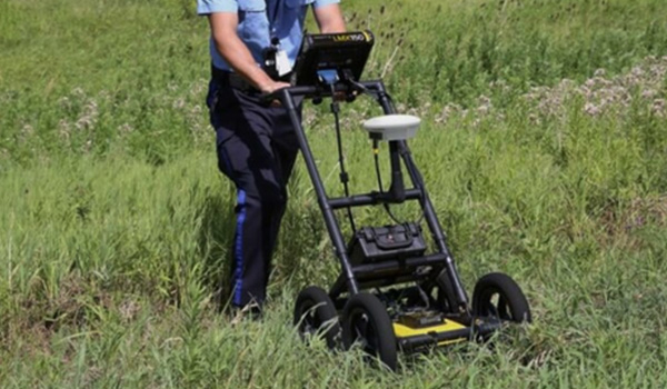
Sensors And Software LMX100™
Rapidly Locate & Mark™ Metallic and Non-Metallic utilities.
Ground penetrating radar price can be a barrier when entering the industry, but as one of the most affordable GPR underground utility locating tools for sale on the market, the LMX100™ completes the locator’s toolbox... more
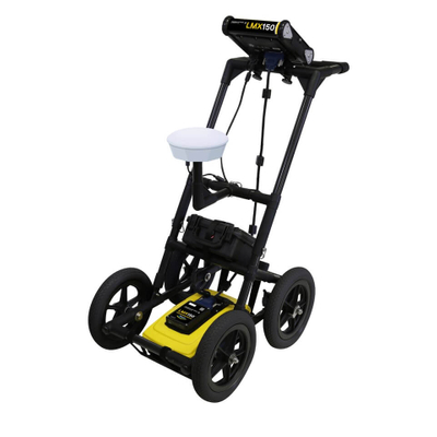
Sensors And Software LMX150™
The LMX150 FINDAR provides locating and mapping capabilities to pinpoint the location of buried metallic and non-metallic utilities. This unit is also used in forensic cases allowing law enforcement to quickly and effectively search for evidence buried under the ground.
The LMX150™ FINDAR® Ground Penetrating Radar system is a compact, high resolution GPR system for utility locating...more

Sensors And Software LMX200™
LMX200™ is the Premier Ground Penetrating Radar (GPR) Utility Locating Equipment on the market today.
The LMX200™ builds on the capabilities of its predecessor, the LMX100™, to offer the best ground penetrating radar utility locating equipment in the market...more
GPR System Price & Comparison Guide (Concrete, Utility & Mapping Applications)
Ground Penetrating Radar (GPR) systems have become essential tools for locating and mapping what lies beneath the surface. Whether you’re scanning concrete for rebar, locating underground utilities, or mapping archaeological sites, the right GPR can save time and prevent costly mistakes. This guide explains what GPR is used for, typical GPR price ranges, a comparison of GPR vs. electromagnetic (EM) utility locators, brand/model comparisons, and which GPR systems are best for specific applications. We’ll also address whether GPR is worth the cost and answer common FAQ about the technology.
What GPR Is Used For
GPR is a non-destructive geophysical method that uses radiofrequency pulses (microwave-band radar) to image the subsurface. A GPR unit sends radar waves into the ground and listens for reflections from buried objects or layers. The result is a cross-sectional image or radargram showing anomalies that indicate things like pipes, cables, or changes in material. Key uses of GPR include:
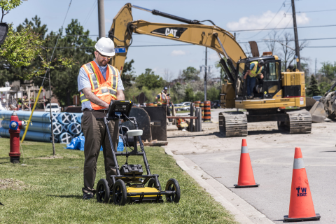
Underground Utility Locating: GPR can detect both metallic and non-metallic utilities (e.g., plastic water pipes or concrete sewers) that traditional cable locators might miss. It’s invaluable for finding PVC pipes, fiber optic conduits, or utilities with broken tracer wires that no longer carry a detectable signal. GPR is commonly used alongside EM locators to ensure no buried lines are overlooked before digging.
Concrete Scanning: For construction and engineering, GPR is used to scan concrete structures (floors, walls, bridges) to locate reinforcing steel (rebar), post-tension cables, conduits, and voids before cutting or coring. High-frequency GPR antennas can reveal embedded objects and thickness of slabs with great detail. This helps contractors avoid hitting critical structural elements or utilities hidden in concrete.
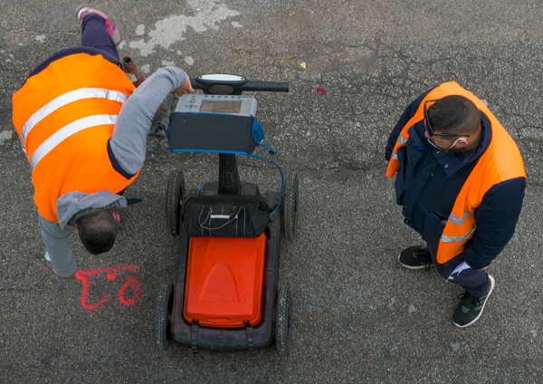
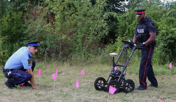
Mapping and Surveying (Archaeology & Forensics): GPR’s ability to image disturbed soils and hidden objects makes it ideal for archaeological surveys, cemetery mapping, and forensic searches. For example, GPR can identify unmarked graves or buried evidence without excavation. It shows soil disturbances, voids, and objects like coffins or containers, aiding archaeologists and law enforcement in finding targets while preserving the site. Modern GPR units even allow creating three-dimensional maps of an area, such as a cemetery, showing grave locations and other features in detail.
- Geotechnical and Environmental Applications: GPR is also used to locate underground storage tanks, map bedrock or water tables, and detect subsurface voids or sinkholes. Because GPR shows changes in material, it can reveal air pockets or cavities that might indicate a void, as well as delineate different soil layers. This is useful for environmental site assessments and engineering geology projects.
In all these applications, GPR provides a more complete picture of the subsurface without digging or drilling. It is safe and non-invasive, since it simply uses low-power radio waves (much like Wi-Fi frequencies) and receives echoes. GPR does not emit any harmful radiation and won’t disturb buried utilities while scanning. The main requirement is that an operator moves the GPR antenna over the ground or structure in a systematic way to scan the area of interest. Modern systems often include an integrated screen that displays the radar data in real time for the user to interpret.
GPR Price Ranges (Entry-Level to Industrial)
Ground-penetrating radar equipment is a significant investment. GPR system price can range from the low tens of thousands to high five figures, depending on capability. Prices vary by the depth penetration, antenna frequency, data features, and ruggedness of the system. Here we break down three general tiers of GPR systems and what to expect at each level:

Entry-Level GPR Systems
Entry-level GPR systems typically cost in the ~$10,000 to $20,000 range. These are the most affordable options for those who need basic subsurface imaging on a budget. Often, entry-level units are single-frequency GPR carts with simpler features. For example, the Radiodetection (Sensors & Software) LMX100 is billed as an affordable utility GPR. Its base price is $18,389. In a similar class, the MALA Easy Locator Standard (HDR) has a list cost around $12k–$15k for its 450 MHz model.
At this entry tier, GPRs will get the job done for basic locating but may have some limitations compared to higher-end units:
Depth and Resolution Trade-offs: Lower-cost GPRs usually come with a mid-range frequency antenna (around 250–500 MHz), which offers a balance of depth and resolution. They can detect typical pipes or objects to moderate depths (a few meters). For instance, the LMX100’s 250 MHz antenna penetrates up to about 8 m (26 ft) in ideal conditions. This is sufficient for most utility work, but entry units won’t include ultra-high-frequency antennas for fine detail or very low-frequency options for extreme depth.
Basic Data Output: Most budget GPRs have a built-in screen for live data but limited recording or analysis features. They often provide a simple radargram view and basic depth estimation. Advanced mapping modes or PC software integration might be absent. Many entry models do not allow full data export. You see the data on-screen and mark targets manually. (Notably, the LMX100 is focused on real-time locating and does not support grid surveys or post-processing like its big brother, the LMX200.)
Fewer Frills: To keep costs down, entry-level units may lack convenience features. For example, they might have a smaller display, no GPS integration, or require manual note-taking of target locations. They are often designed to be simple and easy to use, which is a plus for new users, but this comes at the expense of advanced capabilities. On the upside, simplicity can mean a shorter learning curve for basic locating.
Use Cases: An entry-level GPR is great for occasional utility scans or small projects. If you’re a contractor who sometimes needs to locate a plastic drain line or check a slab for conduits, a basic GPR can pay for itself by preventing hits. These units are also popular in applications like cemetery plot surveys or hobbyist archaeology, where budgets are tight. Just be mindful that in challenging conditions (like very poor soils or need for 3D maps), an entry unit will have performance limits.
- Trade-offs: The main trade-off at the low end is you get coverage of the basics, but not the extras. You’ll still detect pipes, cables, and voids, but perhaps with a bit more effort in interpretation. Build quality on entry units is usually adequate for light to moderate field use, though maybe with shorter warranty periods. For example, some lower-cost GPRs might come with only a 1-year warranty, whereas pricier systems often offer longer coverage. If you only need GPR occasionally and can live without advanced mapping or deep penetration, entry-level systems are the most cost-effective choice.
Professional-Grade GPR Systems
Stepping up to professional-grade GPR means investing roughly $20,000 to $30,000 for a new system. In this tier, you’ll find the flagship models from major manufacturers, the workhorse units designed for daily use by utility locators, surveyors, and engineers. These systems strike a balance of performance and price, offering significantly more capability than entry-level units without veering into ultra-specialized territory.
On Locator Guys, the LMX150 and LMX200 GPR systems fall into this professional range. The LMX150 (500 MHz FINDAR) has a base price of $21,043, and the high-end LMX200 (250 MHz) is listed at $23,697 base. Here’s what to expect from GPR in this class:
Enhanced Features and Data Capabilities: Pro-grade GPRs usually include better user interfaces and data handling. For example, the LMX200 builds on the simpler LMX100 by adding features like Grid Scan mode, SplitView, and MapView for conducting grid surveys and visualizing data in plan view. It also supports an external GPS for precise geo-referencing and allows full data export for post-processing in software (like Sensors & Software’s EKKO_Project). These features let professionals create maps of utilities, generate reports, and integrate GPR data into CAD/GIS, crucial for Subsurface Utility Engineering (SUE) work.
High Sensitivity & Depth Options: Professional units often offer a choice of antennas or even dual-frequency setups. While the LMX series are single-frequency units, other brands like GSSI offer dual-frequency GPR (e.g., 300 MHz and 800 MHz simultaneously) to capture both deep and shallow targets in one pass. In general, pro-grade GPR can reliably detect common utility lines on the order of 10+ feet deep, and larger features even deeper. For instance, GSSI’s UtilityScan system (with appropriate antenna) advertises maximum depths around 10 m (33–35 ft) under ideal conditions. The caveat is always soil conditions (more on that later), but these higher-end systems push depth performance to the practical limits of GPR physics for utility-sized objects.
Better Resolution Imaging: If entry-level gave you a rough sketch, pro GPR gives you a clearer picture. A unit like the LMX150 with its 500 MHz antenna provides high-resolution scans for shallow targets, ideal for finding small pipes or rebar within the top 10 ft. Meanwhile, the LMX200’s 250 MHz antenna maintains good resolution while reaching those deeper utilities ~20 ft down. Professional users might own multiple antennas or systems to swap out based on the job (e.g., a 250 MHz cart for deep utilities and a 1000 MHz handheld for scanning a concrete wall).
Durability and Ergonomics: Pro-tier GPR systems are built for daily field use. You’ll see rugged carts with all-terrain wheels, easily swappable batteries, weather-resistant enclosures, and often lightweight frames (typically fiberglass or carbon fiber to avoid interference). The LMX series, for example, uses a non-metallic fiberglass cart frame that is tough yet doesn’t distort the radar signals. Components like displays are sunlight-visible and glove-friendly touchscreens. All of this reduces downtime and operator fatigue in the field.
Warranty and Support: Manufacturers back their professional models with solid warranties and support. It’s common to see ~2-year warranties on electronics and perhaps longer on the antenna module. Just as important, dealers like Locator Guys provide comprehensive training and 24/7 support with these systems. When you’re investing $20k+, you get not just hardware but access to expert help, software updates, and, in some cases, loaner equipment if something goes wrong. This support network is a big part of what you pay for in the professional tier.
Overall, the professional-grade GPR tier is where most serious users will land. Here you get the capabilities needed for complex jobs: mapping multiple utilities on a city block, scanning an entire building for embedded conduits, or performing a forensic search with confidence. These GPR systems offer the best performance-per-dollar for organizations that rely on them routinely. Unless you have a very specialized requirement, a mid-20s ($k) investment in a pro GPR will cover the vast majority of use cases in utility locating, construction, and mapping.
Industrial / Advanced GPR Systems
At the top end are industrial-grade GPR systems, which can exceed $30,000 and even reach into six figures for specialized configurations. These are the cutting-edge or purpose-built systems for niche applications. Often, industrial GPR setups are not off-the-shelf packages, but rather customized solutions built around specific needs. Some examples include:
Multi-Antenna GPR Arrays: To cover large areas quickly (such as highway roadbed scanning or airport runways), GPR can be deployed in arrays of multiple antennas. These systems (like the IDS Stream or GSSI’s RoadScan setups) use many channels at once to create 3D underground maps at highway speeds. The cost of a multi-antenna array system can be several times that of a single-unit GPR, easily $50k–$100k+, depending on how many antennas and the processing system. These are used by departments of transportation and research institutions for high-resolution mapping of large subsurface structures (e.g., detecting voids under a roadway or mapping rebar in bridge decks across an entire span).
Ultra-Low-Frequency or High-Penetration GPR: While most utility GPR tops out around 250 MHz for depth, there are specialized antennas in the 100 MHz (or lower) range used in geophysical surveys. These can penetrate tens of meters in the right soils (for example, mapping groundwater or bedrock). However, their resolution is very low, and they often require very large antennas (sometimes towed like a sled or deployed from a vehicle). These setups, combined with advanced analysis software, fall in the high price bracket as well.
Highest-Resolution Concrete Scanners: On the other extreme, industrial-grade could mean very high frequency GPR for specific tasks. For instance, a 2 GHz handheld scanner might be used to inspect thin concrete walls for defects. Some advanced concrete scanners even use multiple high-frequency antennas in an array to generate 3D images of rebar networks. These can be costly, though many times the complexity is in the software.
Special Environment GPR: Another industrial niche is GPR systems hardened for extreme environments, think fully submersible GPR for underwater use, or GPR units mounted on drones for surveying hard-to-reach areas. For example, researchers have used drone-mounted GPR to map ice thickness in polar regions. These unconventional platforms involve significant custom engineering and budget.
With industrial-grade GPR, you are often paying for customization, integration, and top-tier accessories. It’s not uncommon for high-end packages to include things like multi-unit synchronization, specialized software licenses, rugged transit cases, and extensive training programs. For instance, a large utility mapping firm might purchase a GPR mapping kit that includes a pro-grade GPR unit, an RTK GPS system, a powerful field tablet, and analysis software, together pushing the price upward but providing a turnkey solution.
Who needs industrial GPR?
The average contractor or utility company likely doesn’t; these systems are typically used by large engineering firms, research agencies, or military units with very specific needs (e.g., penetrating radar for UXO detection, or archaeological surveys over large tracts of land). For most commercial users, the professional range GPR will be sufficient. However, it’s good to know that if you do have an extreme requirement, there are GPR solutions out there, and correspondingly, you should be prepared to invest significantly.
Bottom Line on Price:
Entering the GPR field can be done for under $20k with basic capabilities, but full-featured professional systems run in the $20k–$30k range new. High-end or specialized setups can cost substantially more. Ground penetrating radar price points reflect the complexity of the tech and the value of the data it provides – while expensive, even a $25k system can quickly pay for itself by preventing utility strikes or enabling new billable services (like private utility locating or concrete scanning) for your business. In the next sections, we’ll compare specific brands and models to illustrate what you get for the price.
GPR vs. EM Locating (Critical Comparison)
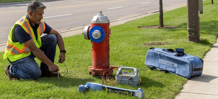
It’s important to understand that GPR is not a direct replacement for electromagnetic (EM) utility locators. Rather, it’s a complementary technology. Traditional EM locators (the wand and transmitter sets used to find cables and pipes) work by detecting electromagnetic signals on conductive lines. This means EM tools excel at tracing metal pipes and cables that can carry a current or signal. If you hook a transmitter to a metal pipe or if a live electric line is buried, an EM locator can usually find it by picking up the signal along the line.
Ground penetrating radar works differently: GPR sends pulses of radar into the ground and detects the reflections from any subsurface structure or object, conductive or not. Where an EM locator might require a pipe to be metal or have a tracer wire, GPR can find plastic, concrete, fiberglass, and other non-metallic utilities by imaging the physical disturbance or material contrast they create. This is a huge advantage when you are dealing with unknown infrastructure. For example, a plastic water main with no tracer wire. GPR can also detect features like underground storage tanks, septic tanks, voids, and even buried foundations that EM locators either struggle with or cannot detect at all.
However, GPR has its own limitations and is not better in all scenarios:
Depth and Range: EM locators can sometimes find very deep or long runs of cable well beyond the range that GPR could penetrate, because an EM signal can travel along a conductor for hundreds of feet. GPR, by contrast, is limited by physics to scanning maybe up to a few tens of feet deep vertically. For example, a utility locator with a low-frequency mode might trace a cast iron sewer line 300 feet down a road, whereas GPR would only see that line when directly above it, and only if it’s within its depth range (perhaps 10–15 feet deep maximum for that pipe size). GPR also requires relatively slow, methodical scanning of an area, whereas an EM locator can quickly be moved along a route to follow a signal. This means EM is often faster for tracing known lines over distance, while GPR is used to sweep an area and find unknown objects.
Soil Conditions: Perhaps the biggest limitation of GPR is soil conductivity and ground conditions. Radar waves do not travel well in certain materials, notably wet, clay-rich soils or soils with high mineral salt content. These types of earth literally absorb or attenuate the GPR signal, greatly reducing penetration. In extreme cases (e.g., saturated clay), a GPR might only see a foot or two below ground, essentially rendered ineffective. EM locators, on the other hand, are less affected by soil type because they rely on conductive coupling, not wave propagation through the soil. This means in certain regions (heavy clay) or conditions (after heavy rain), EM might be the only reliable locating method, whereas GPR shines in dry, sandy, or non-conductive soils.
Target Types: EM locators will only find metal (or lines with a current). They are blind to plastic or concrete structures unless there’s a tracer or sonde inserted. GPR will find both metal and non-metal objects, as well as changes like disturbed soil or voids. That said, GPR might show any anomaly, including rocks or tree roots, so it sometimes requires interpretation to know if an object is a utility or something innocuous. EM gives a very clear that’s a line response (with an audible tone and depth reading) when it works, but has the binary limitation of either the line can carry a signal or not.
Ease of Use and Skill: EM locators are generally considered easier to learn. A technician can be taught to hook up a transmitter and follow the tone with a receiver in a short time. GPR, by comparison, involves looking at radar data profiles, which require training to interpret. Modern GPR systems help with user-friendly features – for instance, the LMX series uses simple icons and automated settings to get started, and even has visual cues like a line indicator when a likely target hyperbola is detected. Still, understanding GPR output (recognizing the hyperbolic signatures of pipes or the layered response of different soils) is a skill honed over time. This is why professional GPR operators often undergo dedicated training courses. Many companies, like Locator Guys, provide free on-site training with GPR purchases to get users up to speed. In contrast, an EM locator might be picked up and effectively used with minimal experience for straightforward jobs.
Practical Usage: In utility surveying, the two technologies are used together for best results. A typical workflow: first, use an EM locator to mark known electric, gas, telecom, and water lines that can be tone-traced. Then use GPR to sweep the area for any unknown or non-toneable lines (like drain tiles, unmarked electrical ducts, or abandoned lines) and to verify there are no discrepancies. GPR might also help resolve questions from EM. For example, if EM indicates a metallic line but you suspect there’s another object nearby, GPR can show if there are two distinct features or just one. Conversely, if GPR finds an anomaly that could be a utility, one might then attempt to hook an EM transmitter to a detectable part of it (if accessible) to positively identify it.
Bottom line, GPR vs EM: They serve different purposes. EM locators are ideal for tracing known conductive utilities over distance, giving you a quick, reliable mark-out for things like power cables and water/gas lines with tracer wires. GPR is ideal for detecting unknowns and non-conductive utilities, and providing a more comprehensive picture of all subsurface features (including foundations, tanks, etc.) in a given area. GPR can not entirely replace an EM locator for everyday use – for one, it cannot discern a specific line running out 100 yards away, but it fills the gaps left by EM technology. That’s why professional utility locators consider GPR as an additional tool in the toolbox. In fact, many would say the two together are necessary for a complete utility locate: EM for what’s traceable, GPR for what’s not.
It’s also worth noting that magnetometers (like handheld magnetic locators) are another complementary tool used specifically for finding iron/steel objects like manhole covers or valve keys. A comprehensive locating operation might use all three: EM, GPR, and magnetometers, each for its specialty. In this guide, our focus is GPR, and next, we’ll compare the leading GPR brands and models on the market today.
Brand & System Comparison (Radiodetection vs. GSSI vs. MALA)
Several manufacturers produce reputable GPR systems for concrete and utility applications. The big three brands you’ll encounter most are Radiodetection (Sensors & Software), GSSI (Geophysical Survey Systems, Inc.), and MALA (Guideline Geo). Each has its flagship products and unique strengths. Below, we’ll compare popular GPR models from these brands, including Radiodetection’s LMX series and comparable units from GSSI and MALA.
Radiodetection / Sensors & Software (LMX Series): Radiodetection’s GPR lineup came from its acquisition of Sensors & Software, a Canadian GPR pioneer. The LMX series, consisting of the LMX100™, LMX150™, and LMX200™, covers entry through high-end utility GPR needs. These are cart-based systems with integrated touchscreen displays, known for being user-friendly and field-rugged. Radiodetection emphasizes the locate & mark simplicity on the LMX100 (for quick scans and marking on site) and the advanced mapping abilities of the LMX200 (for recording data, grid scans, and post-processing). The LMX150 is a mid-tier unit with a higher-frequency antenna tailored for shallow targets and forensics use. Radiodetection’s GPR is widely used in North America, backed by strong dealer support (like Locator Guys’ free training and 24/7 on-call support).
GSSI (UtilityScan series): GSSI is a U.S. company and one of the oldest names in GPR technology. Their UtilityScan systems are considered the industry standard by many private locating firms. GSSI offers modular GPR systems, typically a high-performance control unit (SIR 4000 or newer SIR 30) that can pair with various antennas. For utility locating, GSSI’s popular configurations include a dual-frequency cart (often 400 MHz and 800 MHz antennas together) to allow seeing deep utilities and shallow features in one pass. They also have compact handhelds for concrete (StructureScan series). GSSI GPRs are known for excellent data quality and robust software, though the learning curve can be higher. They tend to be priced at a premium; for example, a dual-frequency UtilityScan with controller can be on the order of $20k+. One GSSI model advertises up to 10 m (33 ft) depth with a lower-frequency antenna option, highlighting their focus on achieving maximum depth in ideal conditions. GSSI provides good support and training, and their systems are used worldwide in both utilities and research applications.
MALA (Easy Locator series): MALA, part of Guideline Geo (Sweden), offers the Easy Locator line, which targets the same utility locating market. The MALA Easy Locator HDR is a popular model featuring a foldable cart and a high-dynamic-range 450 MHz antenna. MALA pushed the concept of HDR (high dynamic range) in GPR, which can improve depth penetration and contrast. The Easy Locator comes in variants like Standard and Pro – the Pro adding GNSS (GPS) integration, 3D grid collection, and post-processing software. MALA systems are praised for being easy to deploy (quick folding, lightweight) and providing clear data. They are also quite competitively priced. The Easy Locator HDR lists around $12,800–$14,800 for the base unit, undercutting many U.S. competitors for a similar mid-range spec. One trade-off is that MALA’s warranty is typically around 1 year (shorter than some rivals), and support in North America is through select distributors. Nonetheless, MALA GPRs have a strong following, especially in Europe and Asia, and are used by utility locators who value their data clarity and cost-value ratio.
Brand Comparison Table: Radiodetection vs. GSSI vs. MALA
When comparing GPR systems across brands, it helps to see key specifications side by side. Below is a comparison of representative models from Radiodetection (Sensors & Software), GSSI, and MALA, focusing on utility and concrete scanning applications:
| Model | Antenna Frequency | Max Depth* | Notable Features and Strengths |
|---|---|---|---|
| Radiodetection LMX150 | 500 MHz (UWB antenna) | ~3 m (10 ft) in ideal soil | High-resolution GPR for shallow targets. Compact cart for tight areas. Optimized for concrete scanning and forensic applications (marketed as FINDAR® for law enforcement). Intuitive interface, same touchscreen as LMX100. Can complement EM locators by revealing small/near-surface objects (e.g., fiber optic lines, rebar, graves) that lower-frequency GPR might miss. |
| Radiodetection LMX200 | 250 MHz (UWB antenna) | ~8 m (26 ft) in ideal soil | Premier utility GPR (~$24K). Builds on LMX100 with advanced features: Grid Scan mode, SplitView and MapView for 2D/3D imaging. Supports external GPS for precise mapping. Allows full data export for post-processing and reporting. Ideal for professional SUE work – you can collect data over large areas and analyze later. Still easy to use in the field, with on-board target mapping and instant mini-reports. |
| GSSI UtilityScan DF | Dual: e.g. 350 MHz and 750 MHz | ~10 m (33 ft) max with lower freq | Dual-frequency utility GPR scans deep and shallow simultaneously. High-end SIR controller with large display. Excellent data resolution and clarity; industry-leading software (layer interpretation, slice views). Widely used by utility locate firms; known for durability and sensor quality. Modular system antennas can be swapped for different jobs (lower freq for geotech, higher for concrete). Higher learning curve and cost (~$20K+ range), but delivers comprehensive results. |
| MALA Easy Locator HDR Pro | 450 MHz (HDR) | ~4 m (13 ft) in ideal soil | Mid-priced utility GPR (~$13K base). All-in-one foldable unit – quick to deploy. High Dynamic Range tech yields improved depth penetration (~20% better than prior models) and resolution. Pro version includes GPS integration and 3D grid mapping. Data can be recorded for post-processing. Lighter weight (~21.5 kg / 47 lb), easy to transport. Shorter warranty (~1 year) but strong performance for cost. Favored for its user-friendly design and clear imagery. |
As the table shows, Radiodetection’s LMX series offers a well-rounded set of options for different needs. The LMX100 is focused on affordability and ease of use, giving users a straightforward way to find utilities that conventional locators miss. The LMX150, with its 500 MHz antenna, targets high-resolution shallow scanning – this is somewhat unique, as many competing products don’t offer a dedicated shallow-focused unit at that price point. It’s well-suited for applications like locating rebar in concrete or shallow service lines, and it’s noteworthy that LMX150 is marketed for forensic investigations (e.g., searching for buried evidence or clandestine graves). The LMX200 is Radiodetection’s top offering, and it competes head-to-head with high-end systems by offering advanced data collection and mapping features. Although it’s single-frequency (250 MHz), the LMX200’s ability to conduct grid scans and interface with post-processing software gives it a similar end result (3D maps, depth slices) as some dual-frequency systems, with a bit more field effort. Radiodetection’s emphasis on simplicity plus support (free training, etc.) means that for many users, an LMX is the fastest route to getting proficient with GPR.
Looking at GSSI, their dual-frequency UtilityScan is a powerful solution, essentially covering what an LMX100 and LMX150 together might do (deep and shallow) in one system. GSSI gear is known for being robust and time-tested. They’ve been making GPR for decades, and their hardware’s reliability is top-notch. The trade-off is usually cost and complexity; a new user might find a GSSI system a bit overwhelming at first, whereas a Radiodetection LMX is often described as plug and play. Larger organizations with experienced geophysicists or geologists on staff often prefer GSSI for its flexibility and the depth of data it provides.
MALA’s Easy Locator in the HDR Pro form is something of a dark horse that has gained popularity because it hits a sweet spot in price and performance. As noted, its base price is significantly lower than an LMX200 or GSSI system, yet it offers an excellent 450 MHz antenna capable of both utility and shallow scans, and includes features like on-board GPS in the Pro package. MALA’s data quality and depth capability (up to ~13 ft) are impressive for the frequency, thanks to that high dynamic range design. The Easy Locator’s foldable design is a plus for transport (fitting in a small vehicle trunk where others might need a truck). The main drawbacks are the shorter warranty and possibly less presence of local support in some regions compared to Radiodetection’s dealer network. However, users often report that MALA’s system is very user-friendly as well, with an interface geared toward quick learning.
In terms of detectable depth, all quality GPRs in this class (Radiodetection, GSSI, MALA) will locate typical utilities in the order of 10 feet deep under good conditions. Differences in depth rating often come down to antenna frequency and soil, not brand per se. For example, Radiodetection and GSSI both offer lower-frequency options (like 250 MHz) for deeper penetration ~20+ feet on large targets, and higher-frequency ~500 MHz for the 3–10 ft range and better resolution. MALA’s 450 MHz sits in the middle, giving perhaps ~13 ft on larger targets, which aligns well with common utility depths. So, when choosing a brand/model, it’s often the feature set, data handling, and user experience that distinguish them more than raw depth performance.
To summarize the brands
Radiodetection (LMX) is great for those who want a capable system with strong support and an easier learning curve. It’s a ready-to-go solution, especially if you value local training and service. GSSI is the go-to for many seasoned pros who need ultimate flexibility and are willing to invest time and money for the best data quality. MALA offers a compelling value, delivering high performance at a lower price, which can be ideal for budget-conscious organizations that still demand professional results.
Best GPR by Application
Because GPR systems come in different flavors (frequencies, configurations, feature sets), certain models will be better suited for certain jobs. Here we outline the best type of GPR system for various applications, from utility locating to concrete scanning, and mention what to look for in each case:
Best for Underground Utility Locating:
For general utility locating, you want a GPR that balances depth and resolution, with a robust platform for field use. A mid-frequency cart-based GPR (around 250–400 MHz) is typically ideal. The Radiodetection LMX200 is a top choice for utility mapping – its 250 MHz antenna can reach the deeper utilities (water mains, sewer lines) while its advanced features like grid scanning and GPS mapping help document everything you find. If you don’t need data export, the simpler LMX100 at 250 MHz will still reliably locate both metallic and non-metallic lines up to decent depths, making it a great field locator’s tool. Competitors like the MALA Easy Locator or GSSI UtilityScan with a ~400 MHz antenna also excel here; they might offer a bit more resolution or depth, respectively. The key is to have good penetration in typical soil (6–10 feet at least) and enough resolution to distinguish utility-sized objects. Also consider GPS integration if you need to mark many points or create maps (LMX200 or MALA Pro packages, or GSSI with external GPS). For pure locate-and-mark work, GPS may be less critical; you can just spray paint the positions on site. Overall, a rugged cart-based GPR with around 250–400 MHz capability is the workhorse for utility locators.
Best for Concrete Scanning:
Concrete scanning is a different animal – here the targets are very shallow (typically 0–18 inches deep) but require high resolution to see small features like rebar, post-tension cables, or conduits in a slab. The best GPR for concrete is a high-frequency system (1 GHz or higher), usually in a handheld or small push-cart form factor. These include devices like the Hilti X-Scan series or GSSI’s StructureScan Mini, which often use 1.5 GHz or 2.0 GHz antennas to get centimeter-level resolution of embedded objects. Such units can clearly image rebar mats, tendon ducts, and even voids or cracks in concrete. They are also compact enough to maneuver on walls or tight spaces. If your primary work is scanning concrete structures (e.g., for building retrofits or concrete cutting), investing in one of these dedicated concrete GPR scanners (which typically cost in the ~$7k–$15k range new, depending on brand and features) is wise. However, if you occasionally need to scan concrete and primarily need a utility GPR, a mid-tier unit like the LMX150 (500 MHz) can serve in a pinch. The LMX150 won’t show rebar as clearly as a 1 GHz device, but it can detect standard rebar in concrete and locate conduit or tension cables within a slab before coring – just with slightly less resolution. It has the advantage of doubling as a shallow utility locator for things like shallow gas lines or fiber optics. In summary, choose ≥1000 MHz specialized scanners for dedicated concrete work, or a versatile ~500 MHz unit if you need a cross-over device. Always scan in a tight grid for concrete, and use marking crayons or labels on the surface to indicate what GPR finds (since you’re often dealing with a mesh of multiple targets).
Best for Archaeology & Forensic Search:
Radiodetection (LMX) is great for those who want a capable system with strong support and an easier learning curve. It’s a ready-to-go solution, especially if you value local training and service. GSSI is the go-to for many seasoned pros who need ultimate flexibility and are willing to invest time and money for the best data quality. MALA offers a compelling value, delivering high performance at a lower price, which can be ideal for budget-conscious organizations that still demand professional results.
Best for Geological / Environmental Surveys:
When it comes to archaeological mapping or forensic evidence searches, the priorities are a bit different. You often need to detect subtle contrasts in soil (e.g., disturbed soil from a grave shaft, or buried objects that might not be metal), and you may be surveying wide areas methodically. A mid-frequency GPR (around 400–500 MHz) is usually the go-to for these tasks, as it provides sufficient depth (~3–4 meters) while still resolving smaller items. The MALA Easy Locator and Radiodetection LMX150/LMX200 have been used in these contexts. In fact, the LMX150 is nicknamed FINDAR® because it’s marketed to law enforcement for finding clandestine graves, weapons, or stashes. Its 500 MHz antenna is high-frequency enough to catch small, shallow anomalies (like disturbed earth from a grave or a buried weapon in a yard), and the system is portable enough to maneuver in tight spots. For archaeology, GPR units that allow full data collection and 3D grid processing are invaluable. This lets archaeologists generate slice maps at various depths, identifying foundations, tombs, pottery caches, etc. A unit like the LMX200 with grid scan and a good post-processing software is excellent for that, as is the MALA HDR Pro with its 3D capability. Archaeologists also sometimes use lower frequency (200 MHz) antennas for deep site investigations (e.g., looking for large structures or voids several meters down), but those are special cases. Generally, a 400–500 MHz with a cart, surveying in a grid pattern, will cover most needs. GPS is helpful in mapping contexts – being able to correlate GPR targets with exact coordinates for site maps or to revisit points. So a system with GPS or at least the ability to mark and measure positions is recommended (or one can use external survey tools to grid out your site). In forensics, time is often critical, and one might be scanning a discrete area, like a backyard. Portability and quick setup of the GPR is key. A unit like LMX150 that can be lifted by one person and rolled out easily has an advantage when deploying to a remote scene. In summary: a medium-frequency, high-resolution GPR with data recording ability is the best choice for archaeology and forensics, providing a good balance between depth and detail to spot the subtle clues underground.
In all cases above, remember that operator skill and survey method matter as much as the hardware. The best GPR will still yield poor results if used haphazardly. Following systematic grid patterns, calibrating your depth estimates (e.g., by doing a test scan over a known target or using known layer interfaces), and adjusting settings (like gain and filters) for the conditions will greatly improve outcomes. Modern GPRs do have auto-calibration and user-friendly presets. For instance, the LMX series has auto gain and filter options to simplify use, but a knowledgeable user can tweak these for even better clarity when needed. So part of choosing the best GPR is also ensuring you have access to good training and support (which is something Locator Guys provides to its customers). Next, we’ll discuss whether these expensive systems justify their cost and how to maximize the return on your GPR investment.
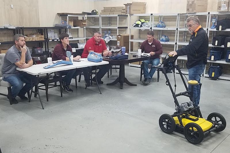
FREE ON-SITE TRAINING
In addition to providing our customers with the best underground utility locator equipment for their needs, Locator Guys offers free, on-site training with every purchase. Our experienced team will not leave your work site or location until your technicians are fully trained and feel comfortable using the equipment. We will also provide your staff with additional, free, on-site training once a year to make sure you are completely satisfied with the utility locator equipment you have purchased.
In addition, we offer free on-site demonstrations of products as well as free customer support 24 hours a day, seven days a week, and free loaners when your equipment is being serviced. We offer our customers, customer service at its best.
Schedule A Free, On-Site Demo Click Here for Local Training Events
Is GPR Worth the Cost?
Given the price tags ($15k, $20k, $25k+), it’s natural to ask: Is purchasing a GPR system really worth it? The answer comes down to your use-case frequency, the problems you need to solve, and the value of information that GPR provides. Let’s break down a few considerations:
Preventing Damage (ROI in safety): If you’re excavating or cutting and relying only on traditional locators, there’s a risk of missing something. For example, a plastic gas service with no tracer wire in the path of your trench. Striking a utility can be extremely costly (not just in repair fees, but also in potential injuries, project delays, and liability). GPR is worth it if it prevents even a single major utility strike. The cost of an accident or utility outage can range from tens of thousands to millions of dollars, far exceeding the cost of the GPR. In this sense, GPR is cheap insurance. Many companies justify their GPR purchase by factoring in how many hits they’ve avoided because the GPR revealed an unmarked line or an unknown obstruction.
Winning More Business: For contractors or service providers, owning a GPR system can open up new revenue streams. For instance, a concrete contractor who adds GPR scanning services can now take on jobs to scan slabs for clients before cutting – that’s an additional service fee each time. Private locating firms often distinguish themselves by advertising GPR capabilities on top of standard locating. In competitive bids (e.g., Subsurface Utility Engineering projects or large construction projects), having GPR in-house can make your proposal more attractive or allow you to tackle portions of the job that others have to sub-subcontract. Over a year, the additional work you get because you have GPR can pay off the equipment. One approach some take: initially rent or subcontract GPR for a few jobs to gauge demand, then purchase their own once they see frequent need. If your business is in utilities, engineering, or construction, chances are the demand for GPR services is rising (as more owners become aware of finding everything before digging), so investing in the capability can keep you ahead of the curve.
Non-Monetary Benefits (Professionalism and Confidence): Using GPR can also bring less tangible but important benefits. For example, it gives confidence and peace of mind on projects, both to you and your clients. When you can tell a client, “We scanned this area with GPR and found no anomalies, so it’s clear to cut,” it provides assurance that you’ve done due diligence. This can enhance your reputation for thoroughness and safety. Also, from a professional development standpoint, adding GPR skills to your team’s toolbox raises their expertise. It can be intellectually rewarding (staff often take pride in mastering the technology), and it signals that your company is using state-of-the-art tools. This brand trustworthiness, showing that you invest in the best equipment, can set you apart. Customers tend to trust providers who use advanced methods to ensure accuracy.
Initial Cost vs. Ongoing Cost: A GPR purchase is largely an upfront cost. The ongoing costs are relatively low – typically just batteries, occasional repairs, and perhaps software maintenance if you use advanced processing software (some companies charge annual licenses). There is the cost of training, but as noted, many dealers include training for free, and additional training resources (online courses, etc.) are available at modest cost. So, after the initial hit, a GPR unit can serve for many years. It’s not unusual for a well-built GPR system to last a decade or more with proper care. They are electronics, though, so obsolescence can happen (newer models with better features come out), but the basic utility of a GPR doesn’t expire. For example, if you bought a Sensors & Software system in 2015, it’s still perfectly useful in 2026 – it might not have the newest software interface, but it finds pipes just the same. This longevity means the investment can be amortized over a long period. Some people also consider resale value. Quality GPR units hold value on the used market. If you decide after a few years to upgrade or you no longer need it, you can often sell a used GPR for a decent percentage of the original price (for instance, used LMX200 units have been seen listed around $17k, not far off from the $23k new price). That resale potential further improves the total cost of ownership.
When It Might NOT Be Worth It: On the flip side, consider scenarios where buying might not make sense. If you only have need for GPR once in a blue moon, you could rent a unit or hire a specialist on those occasions instead of owning one. GPR is also not a magic wand. If you operate in an area with extremely poor GPR conditions (like highly conductive soil everywhere), the utility of the device might be limited. In such cases, other methods (like vacuum potholing or acoustic locators) might be more effective, and you’d use GPR rarely. Another case is if your crew is unwilling or unable to invest the time to learn GPR interpretation. Without a trained operator, a GPR unit could collect dust. Thus, ensure you have a plan for training at least one dedicated user (or that training is provided) so the tool actually gets put to work. If those factors aren’t in place, the cost wouldn’t be justified.
Maximizing Value: To get the most out of a GPR purchase, you should take advantage of all the support and training available. For example, Locator Guys includes free on-site training with every GPR system, plus ongoing annual refreshers at no cost. This is incredibly valuable. It helps your team become proficient faster, which means you start reaping benefits (and revenue) sooner. Additionally, most manufacturers release periodic software updates (often free) that can improve performance or add features; staying up to date will keep your GPR effective for longer. Don’t hesitate to use technical support lines when you have questions interpreting data. Those insights can save you time and build knowledge. Essentially, by fully utilizing training and support (which you’re effectively paying for in the purchase price), you ensure the technology doesn’t go under-utilized.
In conclusion, GPR is worth the cost in the majority of professional use cases where knowing what’s underground is mission-critical. Its ability to prevent damage, expand your service offerings, and improve accuracy makes it a worthwhile investment for many businesses. The key is to match the purchase to your needs (buy the right type of system) and commit to learning and integrating it into your workflow. When used to its potential, a GPR system quickly proves its value by providing critical information that you simply can’t get otherwise, and that information can be priceless when it prevents a disaster or unlocks a new project opportunity.
FAQs
Can GPR replace a traditional utility locator (EM locator)?
No – GPR should be viewed as a complement to, not a replacement for, traditional EM utility locators. Each technology finds things the other cannot. An EM locator is excellent for tracing long, conductive utilities (metal pipes, electric cables) by picking up their signal, but it cannot detect non-metallic lines or any utility with no signal. GPR, on the other hand, can spot plastic pipes, concrete ducts, voids, and other subsurface features by imaging density differences, including utilities that EM locators miss. However, GPR has limitations in certain soils (e.g., wet clay can block radar signals), and it requires interpreting radar data rather than a simple audio tone. In practice, professionals use both: first locating known metal utilities with an EM locator, then using GPR to sweep for everything else (and to double-check areas). GPR is almost like an insurance policy to catch the “unknown unknowns” in the ground. It will greatly enhance your locating capabilities, but you wouldn’t ditch your cable locator wand just because you have GPR. Each tool has its role, and together they provide the most complete results.
How deep can GPR scan?
Ground penetrating radar depth depends on two main factors: the antenna frequency and the soil conditions. In the best conditions (dry, sandy soil with low electrical conductivity), a low-frequency GPR can penetrate extremely deep, potentially up to 30+ meters (100 feet) with very low frequency antennas used in research. But with the antennas used for utility locating (around 250–500 MHz), you’re generally looking at maximum depths on the order of 3 to 8 meters (10–26 feet) in ideal soil. For instance, a 250 MHz system like the LMX100/200 might reach ~25 ft for a large target in dry soil, whereas a 500 MHz system like LMX150 might reach ~10 ft max for larger objects. Real-world GPR depth is usually less because soils are often not ideal. In conductive soils (clays, mineralized ground, or very wet soils), the depth might shrink to only 1–2 meters (a few feet) before the signal attenuates. On the other hand, in very favorable conditions (dry sand or granite gravels), users have detected objects well beyond 20 ft. Target size matters too. A big object (like a fuel tank or void) will be seen deeper than a small object (like a thin cable) since it reflects more energy. Manufacturers’ depth specs (e.g., 35 ft max) usually assume a large target in great conditions. A practical guideline for utility GPR: most pipes and cables can be found in the 0–10 ft range, larger structures in the 10–20 ft range if soil allows, and anything beyond ~20 ft might require special techniques or become hit-or-miss. Always adjust expectations based on soil – if you’re in heavy clay, you may only get shallow readings. It’s wise to consult GPR suitability maps or do a small test scan to gauge penetration in a new area. Importantly, GPR depth is not one fixed number. It’s a sliding scale with soil and frequency. Using a lower frequency antenna can extend depth (at the cost of resolution). Conversely, using a higher frequency (like 1 GHz for concrete) will limit depth to perhaps 1–2 ft, but you’ll see very small features.
In summary: **with the right frequency and soil, GPR can typically scan several meters down, enough for most utilities, but always consider the conditions. If in doubt, talk to GPR experts or perform test scans to understand how deep your GPR can go in the specific project site conditions.
Is GPR difficult to use, and what kind of training is required?
Modern GPR systems are designed to be user-friendly, but there is a learning curve in interpreting the data. Pushing the GPR cart and collecting data is straightforward – most units have automated settings, and the basics can be learned in a day. The challenge is learning what the various patterns on the radar screen represent (e.g., the hyperbola shape that indicates a pipe or cable, the flat lines that might indicate a layer or a large slab, etc.). Manufacturers have greatly improved interfaces: for example, the LMX series uses a high-visibility touchscreen with simple icons and even offers some on-screen tips when a likely target is detected. This reduces the difficulty for new users. That said, becoming truly proficient in GPR interpretation takes practice and training. It’s recommended to get formal training – many GPR dealers and manufacturers include training with purchase. Locator Guys, for instance, provides free on-site training with every GPR system and will stay until your team feels comfortable with operation. They even offer annual refresher training visits at no cost, which is extremely helpful to keep skills sharp. Typically, a new GPR user can perform basic scans after initial training, but over the first few months of use, they’ll continue to learn nuances (like distinguishing tree roots from pipes, or tuning the gain to see deeper objects). Resources like user manuals, online tutorials, and manufacturer support are valuable during this period. In short, GPR is a sophisticated instrument but not overly difficult to learn with proper training. Plan for at least a full day of hands-on training initially. Then use the GPR regularly. The more you scan and correlate with known targets (dig up a test area to see what was showing on the scan), the more confident you’ll become. After some experience, reading a GPR screen becomes almost second nature, much like an experienced sonar operator reading a fish finder. And remember, you’re not alone. The community of GPR users (plus the support from companies like Locator Guys and the manufacturers) is there to help if you encounter challenging scenarios. With time and practice, you’ll gain the eyes to interpret the subsurface and fully unlock the power of your GPR system.

Testimonials
Steve,
Thanks for meeting up with me and bringing out the GPR to Jackson both for delivery and demo. I've spent the last two days swapping out batteries and charging them because I have been running the machine ragged just playing with it and getting use to the settings and figuring out what settings for different terrain and soil conditions. So far in the first 24hrs, I have really started to dial it in and get some good return/images.
Thanks again for the selling the demo and working with me on this item!
Tom Alsip, Alsip Locating Services
Steve,
I want to thank you for coming to Hudson and giving a refresher training course on our Radio Detection and Fault Wizard Equipment. Your training will prove to be beneficial to our operation and especially appreciate your quick response to our needs. We have a few linemen here that don’t operate this equipment every day in their work duties and they felt a little “rusty” on the line and fault locating procedures. Your training was very informative and left us all with the confidence in the equipment that we are using to locate electric lines and cable faults.
In the many years that I have been in the purchasing position I must say that it has been a pleasure to work with you and your staff. I have always received an answer to my questions over the phone from your staff or a callback from you within an hour. From my position, it’s always comforting to know that I can pick up a phone and have a problem solved without delay.
Jeffrey Fullerton, Purchaser, Hudson Public Power
The Industries Best GPR Equipment
The GPR equipment C&S Solutions carries is another tool for damage prevention. The equipment capability to detect buried utilities is on par with the industry standards. The GPR equipment sold and serviced by C&S Solutions would be a great addition to your companies damage prevention practices.
Trusted Manufacturers We Sell and Repair: